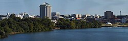
Montgomery

History

Prior to European colonization, the left bank of the Alabama River was inhabited by the Alibamu tribe of Native Americans. The Alibamu and the Coushatta, who lived on the opposite side the river, were descended from the Mississippian culture, which had built massive earthwork mounds as part of their society about 950-1250 AD. They spoke mutually intelligible Muskogean languages, which were closely related. Present-day Montgomery is built on the site of two Alibamu towns: Ikanatchati (Ekanchattee or Ecunchatty or Econachatee), meaning “red earth”; and Towassa, built on a bluff called Chunnaanaauga Chatty. The first Europeans to travel through central Alabama were Hernando de Soto and his expedition, who went through Ikanatchati and camped for one week in Towassa in 1540.

The next recorded European encounter occurred more than a century later, when an expedition from Carolina went down the Alabama River in 1697. The first permanent European settler in the Montgomery area was James McQueen, a Scots trader who settled there in 1716. He married a high-status woman in the Coushatta or Alabama tribe. Their mixed-race children were considered Muskogean, as both tribes had a matrilineal system of property and descent. The children gained status in their mother’s clan.

In 1785, Abraham Mordecai, a war veteran from a Sephardic Jewish family of Philadelphia, Pennsylvania, established a trading post. The Coushatta and Alabama had gradually moved south and west after the French defeat by the British in 1763 in the Seven Years’ War. They moved to Mississippi, Louisiana, and Texas, areas of Spanish rule, which they thought more favorable than the British. By the time Mordecai had arrived, Creek had settled in the area, under pressure from Cherokee and Iroquois warfare to the north. Mordecai married a Creek woman. When her people had to cede most of their lands after the Creek War, she joined them in removal. Mordecai brought the first cotton gin to Alabama.

The Upper Creek were able to discourage most European-American immigration until after the conclusion of the Creek War. Following their defeat by General Andrew Jackson in August 1814, the Creek tribes were forced to cede 23 million acres to the United States, including remaining land in Georgia and most of central and southern Alabama. In 1816, the territory organized Montgomery County, and its lands were sold off the next year at the federal land office in Milledgeville, Georgia.

The first group of European-American settlers to come to the Montgomery area was headed by General John Scott. The group founded Alabama Town about 2 miles (3 km) downstream on the Alabama River from present-day downtown. In June 1818, county courts were moved from Fort Jackson to Alabama Town. Soon after, Andrew Dexter, Jr. founded New Philadelphia, the present-day eastern part of downtown. He envisioned a prominent future for his town; he set aside a hilltop known as “Goat Hill” as the future site of the state capitol building. New Philadelphia soon prospered, and Scott and his associates built a new town adjacent, calling it East Alabama Town. Originally rivals, the towns merged on December 3, 1819, and were incorporated as the town of Montgomery.

Driven by the revenues of the cotton trade, the newly united Montgomery grew quickly. In 1822, the city became the county seat. A new courthouse was built at the present location of Court Square, at the foot of Market Street (now Dexter Avenue). The state capital was moved from Tuscaloosa to Montgomery, on January 28, 1846.

As state capital, Montgomery began to influence state politics, and would also play a prominent role on the national stage. Beginning February 4, 1861, representatives from Alabama, Georgia, Florida, Louisiana, Mississippi, and South Carolina met in Montgomery, host of the Southern Convention, to form the Confederate States of America. Montgomery was named the first capital of the nation, and Jefferson Davis was inaugurated as President on the steps of the State Capitol. On April 12, 1865, following the Battle of Selma, Major General James H. Wilson captured Montgomery for the Union.

In 1886 Montgomery became the first city in the United States to install city-wide electric street cars along a system that was nicknamed the Lightning Route. The system made Montgomery one of the first cities to “depopulate” its residential areas at the city center through transit-facilitated suburban development.

According to the historian David Beito of the University of Alabama, African Americans in Montgomery “nurtured the modern civil rights movement.” On December 1, 1955, Rosa Parks was arrested for refusing to give up her bus seat to a white man, sparking the Montgomery Bus Boycott. Martin Luther King, Jr., then the pastor of Dexter Avenue Baptist Church, and E.D. Nixon, a local civil rights advocate, founded the Montgomery Improvement Association to organize the boycott. In June 1956, the US District Court Judge Frank M. Johnson ruled that Montgomery’s bus racial segregation was unconstitutional. After the US Supreme Court upheld the ruling in November, the city desegregated the bus system, and the boycott was ended. Opponents organized mob violence with police collaboration at the Greyhound Bus Station during the Freedom Ride of May 1961. Outraged national reaction resulted in the desegregation of interstate public transportation.

Montgomery, Alabama
City
Montgomery Alabama panorama.jpg
Flag of Montgomery, Alabama Flag Official seal of Montgomery, Alabama Seal
Nickname(s): “The Gump”
Location in Montgomery County and Alabama Location in Montgomery County and Alabama
Montgomery, Alabama is located in USA
Montgomery, Alabama
Montgomery, Alabama
Location in the United States
Coordinates: 32�21?42?N 86�16?45?W / 32.36167�N 86.27917�W / 32.36167; -86.27917Coordinates: 32�21?42?N 86�16?45?W / 32.36167�N 86.27917�W / 32.36167; -86.27917
Country United States
State Alabama
County Montgomery
Incorporated December 3, 1819
Government
 o Mayor Todd Strange (R)
Area
 o City 156.19 sq mi (404.53 km2)
 o Land 155.38 sq mi (402.43 km2)
 o Water 0.81 sq mi (2.09 km2)
Elevation 240 ft (73 m)
Population (2013)
 o City 201,332 (US: 111th)
 o Urban 263,907 (US: 142nd)
 o Metro 373,510 (US: 140th)
Time zone CST (UTC-6)
 o Summer (DST) CDT (UTC-5)
ZIP code 360/361/367/36800
Area code(s) 334
FIPS code 01-51000
GNIS feature ID 0165344
Website www.montgomeryal.gov