
| Millbrook, Alabama | |
|---|---|
| City | |
 Millbrook City Hall
 |
|
| Motto: “Comfort, Convenience, Community” | |
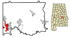 Location in Elmore County and the state of Alabama
 |
|
| Coordinates: 32�29?51?N 86�22?7?W / 32.49750�N 86.36861�W / 32.49750; -86.36861Coordinates: 32�29?51?N 86�22?7?W / 32.49750�N 86.36861�W / 32.49750; -86.36861 | |
| Country | United States |
| State | Alabama |
| Counties | Autauga, Elmore |
| Government | |
| o Type | Mayor/Council |
| o Mayor | Al Kelley (R) |
| Area | |
| o Total | 13.1 sq mi (33.9 km2) |
| o Land | 12.8 sq mi (33.2 km2) |
| o Water | 0.3 sq mi (0.7 km2) |
| Elevation | 190 ft (58 m) |
| Population (2013) | |
| o Total | 15,112 |
| o Density | 1,142.9/sq mi (441.2/km2) |
| Time zone | Central (CST) (UTC-6) |
| o Summer (DST) | CDT (UTC-5) |
| ZIP code | 36054 |
| Area code(s) | 334 |
| FIPS code | 01-48712 |
| GNIS feature ID | 0122814 |
| Website | http://www.cityofmillbrook.org/ |